How the Medan Metropolitan Area (Indonesia) uses mobile phone data to shape mobility
Conducting surveys to elaborate a Sustainable Urban Mobility Plans (SUMP) during Covid pandemic remains a major issue for most cities. The decrease of the mobility and the shrinkage of the traffic’s flow due to Covid restriction measures raises an important question: how to elaborate mobility scenarios that could answer to the need of the inhabitants over the years and even decades?
Medan Metropolitan Area[1], which has launched the elaboration of its SUMP in November 2020, is currently facing this issue. Under the umbrella of MobiliseYourCity Partnership, this project received the financial support of the Agence Française de Développement (AFD) and is implemented by the international consultant Egis. To find an answer to this issue, the consultant Egis looked for complementary data to solve the problems raised by the Covid situation.
Collecting and analysing data
In its methodology and during the SUMP diagnosis phase, the consultant Egis engaged into a large data collection. For instance, at the scale of the metropolitan area, in addition to traffic surveys, a household survey was conducted and around 40,000 people were interviewed. However, this household survey occurred during the pandemic period (first quarter of 2021). If the data collection was large enough in terms of the interviews, the collected data were done during Covid period and would have a bias due to the reduction of the mobility of the inhabitants. Planning mobility and elaborating mobility scenarios for the next 5, 10 or 15 years ahead must be based on data that describes a more normal situation.
In this regard, the international consultant Egis decided to use mobile phone data to have a comprehensive understanding of the mobility pattern before and during the pandemic. In recent years, several research has demonstrated that digital footprints from mobile phones can be exploited to generate data that are useful for transport and mobility planning. This is particularly true in the context of cities and countries that see an increase of the smartphone penetration in the population and a reliable access to the internet. This can be applied to the context of Medan.
In order to compare the pre-Covid and during Covid period situation in Medan by using mobile phone data, the consultant Egis engaged a commercial partnership with Telkomsel, the major mobile operators in Indonesia. The data shared by the mobile phone operator nonetheless had to be compatible with the study (i.e. the SUMP) as it should take into account the exact perimeter of the SUMP study that is all the Medan Metropolitan Area. This is one of the conditions to consolidate the Origine-Destination (OD) Matrix.
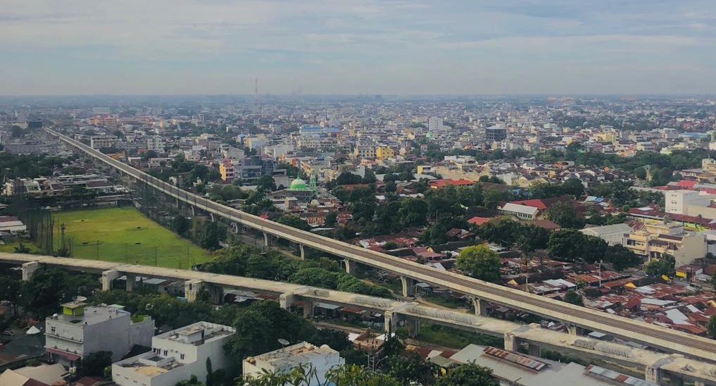
Medan City view (F. Marterer)
A technical challenge with positive outcomes
However, access and exploit mobile phone data is particularly technically challenging as it was a “premiere” for the Indonesian operator. As a result, the consultant Egis managed to exploit and use a set of data on a range of 10 days pre-Covid period and 10 days during Covid pandemic. The transferred mobile phone data are anonymous but could reveal a large number of phone tracks to feed the initial OD matrix set up by the consultant.
The main outcomes of using such mobile phone data shown finally an interesting result regarding the behaviour of the inhabitants of this Indonesian metropolis. If the movements in between districts in the metropolitan area decreased by approximately 15% between the pre-Covid period and the pandemic period, the movements into the districts, that means at a very local scale, increased by approximately 5%.
Based on those complementary data (e.g. survey households and mobile phone data, as seen in the image below) the consultant Egis will elaborate mobility scenarios with the different stakeholders[2] and discuss them to go further into the SUMP elaboration.
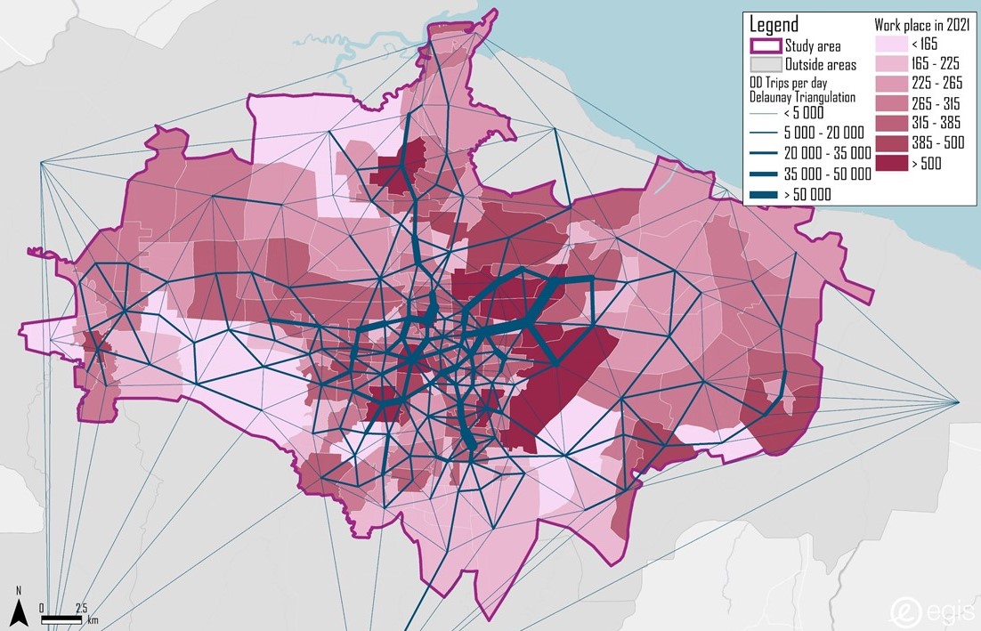
Consolidated OD Matrix that combines household surveys and use of mobile phone date (Source: Egis).
This experience shows how mobile phone data can be used in the context of emerging cities as the number of smartphone users is growing. If exploiting mobile phone data for mobility planning remains occasional in Indonesia, it was a successful first experience with the guidance and the expertise of the international consultant, which will help Medan shape the future of its mobility systems.
[1] Located in the North Sumatra province, Medan Metropolitan Area includes the cities of Medan and Binjai, and the regencies of Deli Serdang and Karo. This metropolitan area is also known as “Mebidangro.”
[2] That includes the technical departments of the different cities and regencies of the metropolitan area as well as the Transportation Agency of North Sumatra Province (region of Medan) and the Regional Development Planning Agency (BAPPEDA) of North Sumatra Province.